.png?width=161&height=72&name=Logo%20light%20tr%20(1).png)
Map Preferences allow you to personalize how information is displayed on the Tracking map. You can choose your preferred map type, control which locations and map components are visible, and adjust how information is displayed.
Your Map Preferences are personal to your user account. Changes you make affect your own map experience and do not change the settings for other users.
To access these settings, go to Settings > Map Preferences.
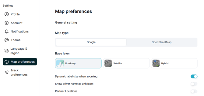
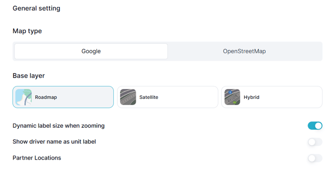
General Settings
General Settings control the overall appearance and behaviour of the map.
|
Setting |
What it does |
|---|---|
|
Map Provider / Type |
Selects the map provider used to display the map. |
|
Base Layer |
Changes the visual style of the map, such as Road/Street, Satellite, or Hybrid, when supported. |
|
Dynamic Label Sizing |
Automatically adjusts unit label sizes as you zoom in or out. |
|
Show Driver Name as Unit Label |
Displays the assigned driver's name on the unit label. |
|
Partner Locations |
Shows or hides partner locations on the map, where available. |
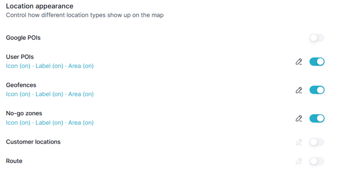
Location Appearance
Location Appearance controls how saved locations and other location information are displayed on the map.
Depending on the available map features, location types can include:
- Google Points of Interest (POIs)
- Points of Interest (POIs)
- Geofences
- No-Go Zones
- Customer Locations
- Routes
For each supported location type, you can adjust how it appears on the map.
|
Option |
What it does |
|---|---|
|
Visibility |
Shows or hides the selected location type. |
|
Icon |
Shows or hides its map icon. |
|
Label |
Shows or hides its name on the map. |
|
Area |
Shows or hides its boundary or area, where applicable. |
|
Zoom Threshold |
Controls how far you need to zoom in before the location is displayed. |
|
Group Picker |
Allows you to display locations from selected groups only. |
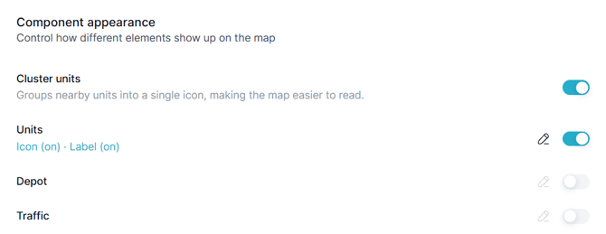
Component Appearance
Component Appearance controls which operational items are visible on the Tracking map.
|
Component |
What it does |
|---|---|
|
Cluster Units |
Groups units that are close together to reduce map clutter. |
|
Units |
Shows or hides tracked units on the map. |
|
Depots |
Shows or hides depot locations. |
|
Traffic |
Shows traffic information when supported by the selected map provider. |
Tip: Set up your Map Preferences based on the information you use most often. Showing only the locations, labels, and map components you need can make the Tracking map easier to read and help you find important information more quickly.